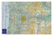
3D Aerochart Seattle - Pacific Northwest
MFR Model# 3D SEATTLE
Overview
|
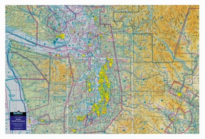
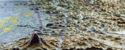
This 3D sectional wall chart is precisely molded into the true shape of Seattle and northwest Washington terrain. This unique chart covers from the Olympic Peninsula and Pacific Ocean to Mt. Rainier and the Northern Cascades -- 238 miles of dramatic topography. Displayed on a wall of a home, office or hangar, these 3D charts make for a striking display of the mountainous terrain and how the hazardous high terrain relates to aviation/airspace. Northwest mountain pilots will study this chart again and again to review past flights or plan new ones. Made with a digital inkjet printing process on a rigid plastic sheet, which is then molded to a precise terrain model. |
WARNING: Cancer and Reproductive Harm - www.P65Warnings.ca.gov. |
Specifications
- Scale: 1 : 500,00
- Size: 30" wide x 20" tall
Q&A
Please note, Aircraft Spruce's personnel are not certified aircraft mechanics and can only provide general support and ideas, which should not be relied upon or implemented in lieu of consulting an A&P or other qualified technician. Aircraft Spruce assumes no responsibility or liability for any issue or problem which may arise from any repair, modification or other work done from this knowledge base. Any product eligibility information provided here is based on general application guides and we recommend always referring to your specific aircraft parts manual, the parts manufacturer or consulting with a qualified mechanic.




 FREE Shipping
