SAME DAY SHIPPING ON ORDERS PLACED BY 4 PM | 877-4-SPRUCE
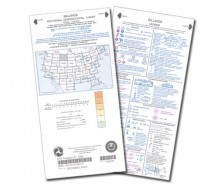
VFR Helicopter Detroit
$13.25/Each
Part# 13-07847
MFR Model# HELDET
MFR Model# HELDET
Overview
|
Please note, all non-stocking charts will be assessed a dropship fee at time of invoicing Helicopter Route Charts are four-color charts that depict current aeronautical information useful to helicopter pilots navigating in areas with high concentrations of helicopter activity. Information depicted includes helicopter routes, four classes of heliports with associated frequency and lighting capabilities, NAVAIDS, and obstructions. In addition, pictorial symbols, roads, and easily-identified geographical features are portrayed. Since helicopter charts have a longer life span than other FAA products, all new editions of these charts will be printed on synthetic paper. These charts are updated as requested. |
WARNING: Cancer and Reproductive Harm - www.P65Warnings.ca.gov. |
Documents
- Click here to access the Dates of Latest Editions (DOLEs) and FAA 28 and 56 Day Aeronautical Product Schedule.
- Download the New York Sectional, New York TAC, and Boston TAC effective dates modified
Q&A
Please note, Aircraft Spruce's personnel are not certified aircraft mechanics and can only provide general support and ideas, which should not be relied upon or implemented in lieu of consulting an A&P or other qualified technician. Aircraft Spruce assumes no responsibility or liability for any issue or problem which may arise from any repair, modification or other work done from this knowledge base. Any product eligibility information provided here is based on general application guides and we recommend always referring to your specific aircraft parts manual, the parts manufacturer or consulting with a qualified mechanic.




 FREE Shipping
